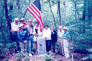
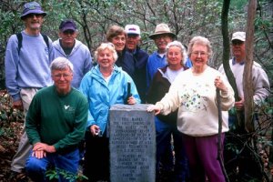
Friends of the North Fork partnered with the Forest Service to locate the source of the North Fork in 1989, and erected a stone monument at the location on Earth Day 1990.
The monument reads:
This marks the First Spring of the North Fork Shenandoah. Latitude – 38″ 39′ 20″ N Longitude – 79″ 5′ 20″ W Elevation – 3402 Ft. A.S.L. Miles to Mouth N.F.S.R. 128.5 Placed by Friends of the North Fork Shenandoah River on Earth Day 1990.
Click here for a map to the monument, but NOTE…the roads require four-wheel drive and are in very bad condition.
Directions to the monument:
Travel west from Broadway, VA on Route 259 (towards West Virginia). Turn left onto Route 818 (Little Dry River Road). Follow Rt. 818 for 11.4 miles. When it turns into a gravel road, you know you’ve entered the National Forest. The dirt road continues upward (and is a very rough road) for a couple of miles. Nearing the top, there is a road that branches off to the right. Stay on the main road. (The road to the right takes you up over the ridge and down the other side, which eventually brings you out at Criders.) The main road continues a little further up until you reach the top of the mountain and an open area where there is a grassy helicopter landing. Once on top, the road splits — stay to the right for about 100 yards or so. There will be an opening in the woods where a truck trailer used to be but was moved out a couple years ago. There is still maybe an old outhouse and the remains of a cabin at this spot. This is a good place to park. Walk back on the road a little ways and look for the trail on the northwest side of the road. There is no sign, but there is a small trail that leads to the stone monument – the monument is about 100 feet from the road.


