The following reports, sites, and other information sources may help those researching questions about the North Fork and the Shenandoah River Basin as a whole. (Keep scrolling, there’s a lot here!)
River Conditions
Our river can sometimes be dangerous. Be safe and have fun.
Read Friends of the North Fork’s general Safety Guidelines for recreation in the North Fork here.
Use these links to hydrographs from the National Weather Service to check on river flood conditions:
Cootes Store west of Broadway (includes predictions)
Mount Jackson (current conditions only)
Burnshire Dam at Woodstock (current conditions only)
Strasburg (includes predictions)
Current Flow Estimates for North Fork Shenandoah River from United States Geologic Survey
USGS Cootes Store Flow Gage (West of Broadway)
View many more gages in an interactive map of the entire Shenandoah River Basin using the Water Window at Friends of the Shenandoah River.
Why does USGS spell gauge as “gage”?
Maps


Historic River Maps
Our friends at Fort Egypt in Page County have assembled a great collection of early maps including James Herron’s 1832 trace of the river. Some of their image files are quite large but well worth viewing. Visit the Fort Egypt website to see them all.
Public River Access Locations
We frequently get asked about good public access points for getting into the North Fork. Visit Shenandoah County has put together a list of public access points within the county, which can be accessed here. Please do note that much of the land along the North Fork is privately owned, and people must only enter the river from those with designated public access.
General Overview of the Watershed
North Fork of the Shenandoah River, Watershed Assessment, Virginia and West Virginia, June 2008 USDA/NRCS, Richmond, Va.
South Fork Shenandoah Rapid Watershed Assessment February 2008, Virginia Dept. of Conservation and Recreation and the USDA/NRCS
Water Quality Monitoring (Get Involved)
Interactive Water Window — a mapping tool with citizen monitoring sites in the entire Shenandoah River Basin, Friends of the Shenandoah River, updated regularly
The Status of Water Quality in the Rivers and Tributaries of the Shenandoah River Watershed, Friends of the Shenandoah River, 2007
Virginia’s “Impaired Streams” List Virginia Dept. of Environmental Quality’s Draft 2016 305(b)/303(d) Water Quality Assessment Integrated Report
Smith Creek information
The following report is big, dense, and fascinating. Smith Creek is an agricultural tributary of the North Fork and is one of several “showcase” watersheds in the Chesapeake undergoing extensive research and restoration efforts. Lessons about nutrients, groundwater, and sediment in Smith Creek may be applicable to much of the Shenandoah.
Spatial and temporal variation of stream chemistry associated with contrasting geology and land-use patterns in the Chesapeake Bay watershed—Summary of results from Smith Creek, Virginia; Upper Chester River, Maryland; Conewago Creek, Pennsylvania; and Difficult Run, Virginia, 2010–2013
Scientific Investigations Report 2016-5093
Prepared in cooperation with the U.S. Environmental Protection Agency Chesapeake Bay Program
By: Kenneth E. Hyer , Judith M. Denver, Michael J. Langland, James S. Webber, J.K. Böhlke, W. Dean Hively, and John W. Clune
USGS Smith Creek Flow Gage (Note: this is one of the first stations in the country with “real time” chemical nutrient readings as well as general flow information.)
Livestock and other Agricultural Sectors
 Impacts of Livestock and Resident Water Consumption on Groundwater Levels
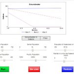
In 2018, students in JMU’s ISAT 391 class developed a model to demonstrate how population changes of various types of livestock would impact the groundwater levels in the North Fork watershed. You can experiment with the online simulator which is found here.
2012 Agricultural Census Shenandoah County Profile sheet
USDA National Agricultural Statistics Service (Virginia page)
Water Pollution from Livestock in the Shenandoah Valley Environmental Integrity Project, 2017
Habitat and Low-Flow
Water Supply
Upper Shenandoah River Basin Water Supply Plan (includes Rockingham County)
Northern Shenandoah Regional Water Supply Plan 2011 (includes Shenandoah, Warren, Frederick, etc.)
Drought Streamflow Probabilities for Virginia (USGS)
Virginia Water Resources Research Center Virginia Tech
River and Fish Health
Shenandoah Algae Virginia Dept. of Environmental Quality
A Decade of Fish Disease and Mortality Investigations Virginia Dept. of Game and Inland Fisheries, updated 2016
Investigation of Organic Chemicals Potentially Responsible for Mortality and Intersex in Fish of the North Fork of the Shenandoah River, Virginia, during Spring of 2007, USGS with Friends of the North Fork, 2008.
2015 Shenandoah River E. coli Monitoring Report, Friends of the North Fork of the Shenandoah River and Friends of the Shenandoah River
Water Law
Shenandoah Riverkeeper et. al. vs. US EPA Lawsuit concerning algae and excessive nutrients